
http://www.ncaction.org.uk/search/entry.htm?id=1447
Dot distribution maps are a type of thematic map. The theme of this GIS dot map is the population in
http://www.ncaction.org.uk/search/entry.htm?id=1447
Dot distribution maps are a type of thematic map. The theme of this GIS dot map is the population in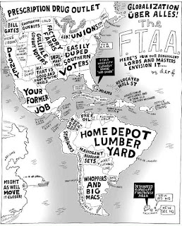
http://www.libertythink.com/2005/08/globalization-uber-alles-ftaa-decline.html
A propaganda map contains Information that is spread for the purpose of promoting some cause. The map above was constructed to demonstrate the reason for the “decline of
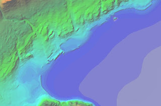
http://iodeweb5.vliz.be/oceanteacher/resources/other/GISModules/Module_h/module_h2.html
Hypsometric maps are a form of topographic map. Similar to topographic maps, hypsometric maps show changes in elevation; however, the difference being that hypsometric uses color to denote changes, whereas, topographic maps use lines.
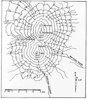
http://www.geo.mtu.edu/volcanoes/fuego/topoair2.html
Above is a topographic map of twin volcanoes named Fuego and Acatenango; which are located in

http://nationalatlas.gov/mld/plss00p.html
PLSS refers to the Public land Survey System. This is a grid-like system used in most of the
 http://www.satimagingcorp.com/svc/cadastre_and_land_records.html
Cadastral maps show land ownership; these maps are usually used for the purpose of taxation. Cadastral derives from the word cadastre, which is a register, with details of the area, the owners and the value of the real property of a country. This map is a satellite image of an area in
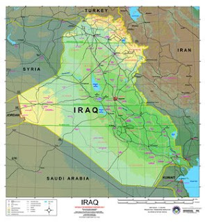
erg.usgs.gov/
The purpose of a planimetric map, such as this map of
 www.uky.edu/~ulack/
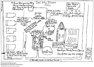
A mental map is based on an individual's personal experience of how he or she remembers a particular geographic area. The cartographic representation above depicts an individual’s interpretation of his home town in the 1940’s.
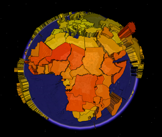
Thematic maps are maps that relate a single theme or purpose. An example would be a map that demonstrates voting demographics by political party (red state, blue state). This particular thematic map represents the fertility rates (Children per woman) throughout the world. The darker colors are higher fertility; all countries are represented on a color scale from darkest to lightest. This is also an example of a choropleth map.
http://blog.thematicmapping.org/2008/03/first-thematic-map-examples.html
